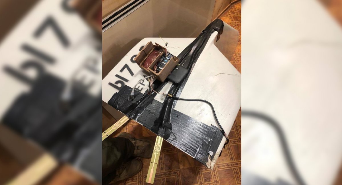
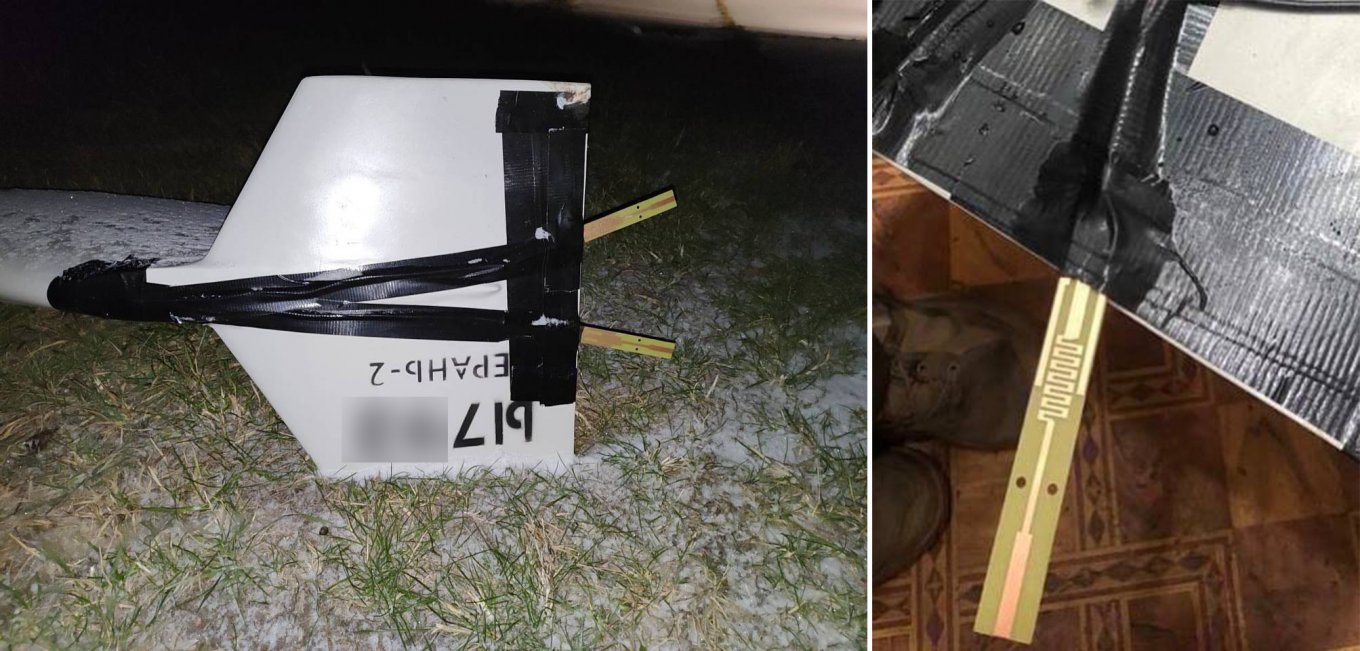
The russian invasion forces began experiments with installing 4G modems on Shahed-136 loitering munitions, a development evidenced by photos circulating on the internet and confirmed by EW/communication expert Serhii Flesh.
Presently, the upgrade appears as a test prototype. The "upgrade" is quite literally attached with a sticky tape and employs a basic combination of ready-made units, including a 4G modem, a power bank, and a few extra antennas. Despite the crude execution, the results of these experiments may transform into devices we'd be able to see more often in the future.
Read more: Black Shahed-136: russian Painted the Suicide Drones for a Nighttime Attack on Kyiv
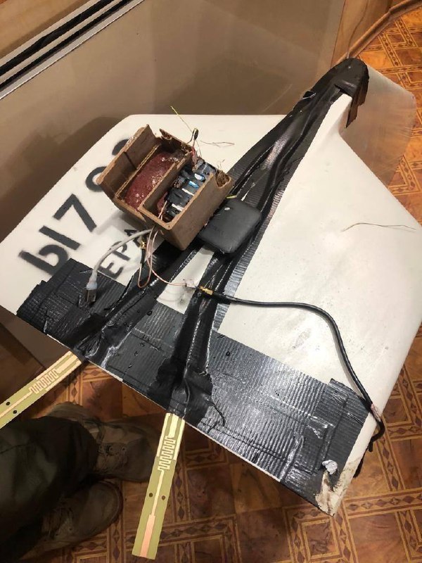
The main question revolves around the purpose of such modifications. The first immediate assumption was the possibility for data transmission directly from Shahed. Ordinarily, once launched, a Shahed operates autonomously without any connection to a pilot on the ground. However, the added attachments could enable the transmission of crucial data, such as Shahed's current coordinates and flight parameters. This information would help the russians track the drone's movements and create more effective routes to evade Ukrainian air defense systems.
The second assumption was that 4G-powered devices grant the ability to alter the drone's course mid-flight.
The other aspect to keep in mind is that integration of 4G devices may facilitate navigation based on Location-based service (LBS), a standard function for many cell network operators. LBS allows approximate coordinates to be obtained without satellite navigation, utilizing cell tower identifiers and, in more advanced versions, by measuring the time it takes the signal to transit between different towers.
It is this function that allows local commercial services to receive data on the location of a specific phone.
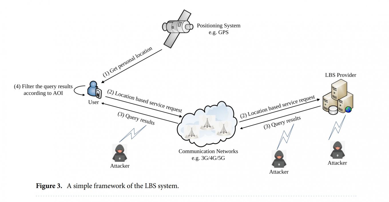
This function, especially if based on signal transit time measurements, can give an accuracy of up to 100–150 meters. While this method lacks pinpoint accuracy, it serves as a cost-effective, additional navigation system that supplements existing technologies.
It might work exceptionally well for Shahed-type loitering munitions, which rely on satellite navigation and a relatively basic autopilot with an error margin 5% of the distance traveled.
In other words, even if satellite navigation is suppressed, a Shahed-136 equipped with this additional system can reset the error of its own primitive inertial system, as well as identify satellite navigation spoofing.
The quick revelation of russian efforts to advance their suicide drones in this direction offers Ukrainians the opportunity to prepare countermeasures at the highest level. The state, performing the role of both the regulator of mobile communications in general and each specific operator in particular, can implement temporary limitations on network functionality in regions under threat of aerial attacks.
Read more: Pokrova EW System is a Real Game-Changer in Ukrainian Fight Against Shahed-136 Drones and Cruise Missiles, That Renders GPS Receivers Useless


