
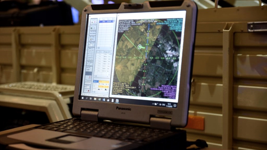
The Harza PSSR is provided with the capabilities for the detection of (slow) moving targets against the background of stationary surroundings; detection of low-RCS aircraft in low-altitude airspace; finding out data of detected targets, including azimuth, range, radar cross section (RCS), radial velocity, and Doppler spectrum width, with a target height finding capability provided as an optional extra. The radar output data can be integrated with geographic information system (GIS) data to allow all weather, 24-hour security surveillance of a facility’s perimeter, territory, and approach routes.
Read more: Straight on target
The Harza PSSR has been developed as an effective, adequate response to the most challenging threat posed by unmanned aircraft that are designed to deal with a wide variety of tasks ranging from reconnaissance, surveillance, and intelligence gathering to surface-to-ground attacks. A drone threat cannot be neutralized or destroyed before it is detected and its position is accurately localized. But this, as it turns out, isn’t so easy to achieve. The larger the RCS of a given target, the easier it is for a radar to detect the target. Relatively large aircraft have larger RCS and hence are more visible to a radar. But the threat detection problem is seriously complicated where the threats are modern, low-RCS combat UAVs and especially quadcopter drones built with an extensive use of plastic materials. Furthermore, targets like e.g. quadcopter drones are designed such as to fly at low speeds, making their detection even more challenging.
The Harza technology team have been able to handle all the challenges pretty well. Having completed the required trials and evaluation cycle, the Harza PSSR has already found markets both in and outside of Ukraine, thus proving its high competitive ability. The new radar is effective against targets in the air, on the ground, and at sea. In particular, it can detect a small, 0.01 sq.m. RCS drone from 7 km, a human being from 18 km, and a vehicle-sized target from 30 km away while being able at the same time to automatically track up to 200 targets simultaneously.
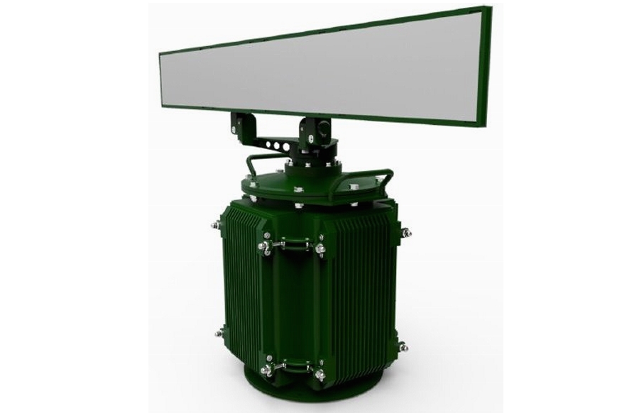
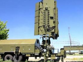
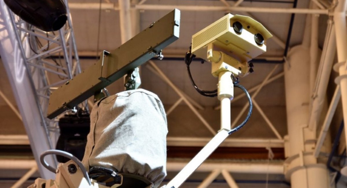
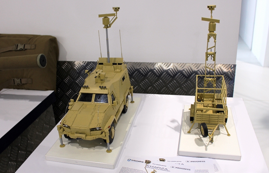
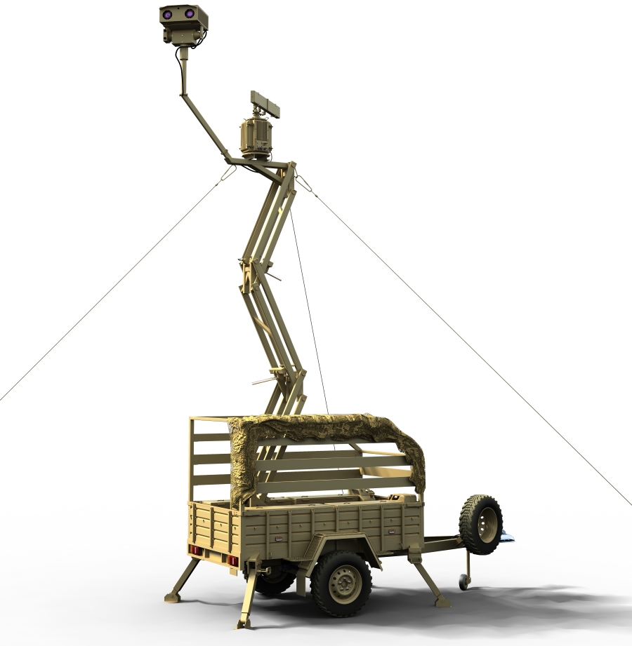
The Harza PSSR system consists of an automated Technical Observation Post (TOP) and a hardware/software package for system control and data processing. The technology is advantageous for its compact design, allowing integration onto a single-axle car trailer to facilitate fast, low visibility movement. The system takes just 7 minutes to go from stowed to ready configuration.
The Harza PSSR has been developed by the State-run Progress Import/Export Trade Firm, in a collaboration with the Ukrainian Academy of Sciences’ Institute of Radio Astronomy.
The mobile Perimeter Security Surveillance Radar (PSSR) system ‘Harza’ is designed to perform the tasks as follows:
- all weather, 24-hour security surveillance of a facility’s perimeter, territory and approach routes by scanning a full 360-degree sector or a specific sector of interest;
- detection of slow moving targets, on land or at sea;
- detection of low-RCS, low-altitude drone threats;
- finding out data of detected targets, including azimuth, range, radar cross section (RCS), radial velocity, and Doppler spectrum width.
The Harza PSSR will come with operational capabilities for the following:
- automatic detection and classification of moving targets, including low-RCS aircraft threats while flying at 10-15 to 600 m altitudes, using radar surveillance;
- automatic slew-to-cue of EO camera sensors based on radar track;
- automatic target tracking;
- display of target icons and radar fields on the surveillance area map (digital map);
- visual/audio alarm signal generation if an incoming threat is detected;
- archive search by date, target class or operator’s comment.
Read more: PD-1 UAV. Hybridity and modularity