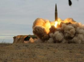
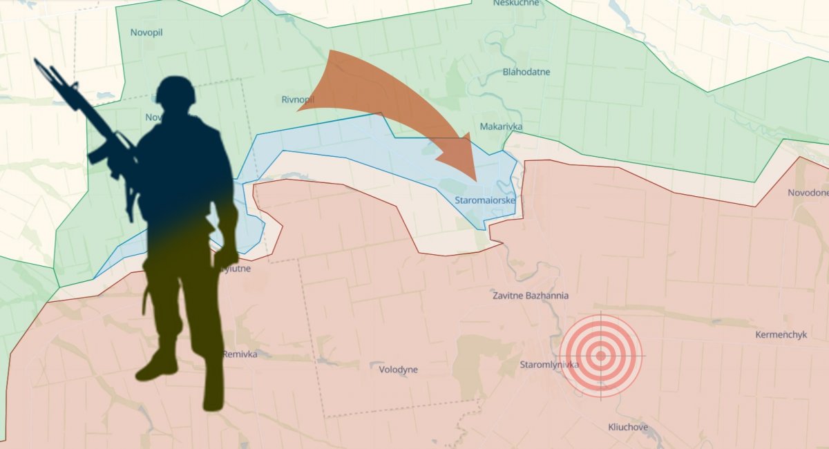
A successful offensive carried out by the Ukrainian Armed Forces, more specifically the 35th Marine Brigade and the 7th "Arei" Battalion of the Ukrainian Volunteer Army of the Territorial Defense Forces resulted in the liberation of the Staromaiorske village from russian occupation.
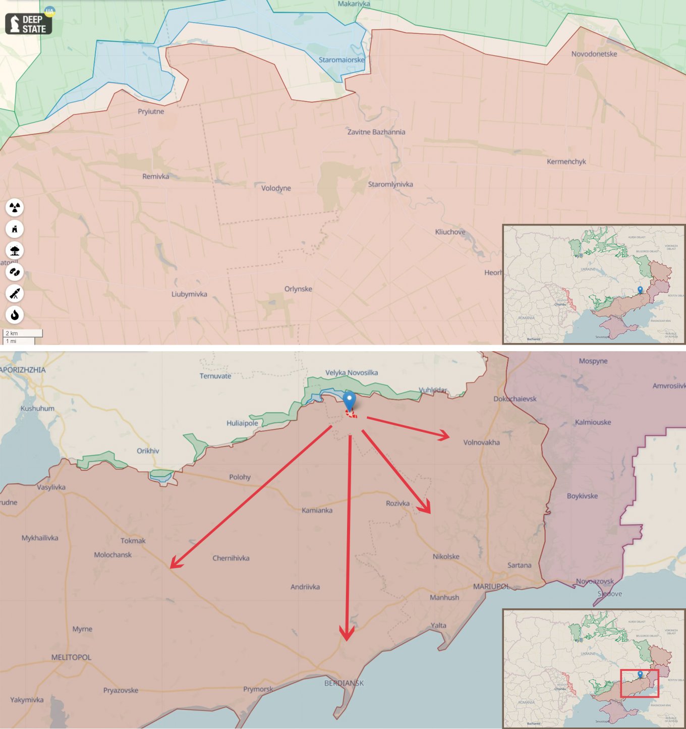
This achievement is significant for the Ukrainian counteroffensive as it is a step on the doorway of Staromlynivka – an important settlement, sort of a crossroad from which multiple attack directions open. Some of them are: toward Mariupol, toward Berdiansk in the south, or toward Volnovakha to the east.
Read more: Ukraine’s SOF Operators Eliminate russian Military, Take Captives in the Southern Direction (Video)
The idea has been consistent ever since the Ukrainian forces started fighting for a high ground called the Vremiivka Ledge in mid-June when russians were pushed out from three villages in succession: Neskuchne, Storozhave, and Blahodatne.
However, we should not pay attention only to the "flat' map but also take terrain into account. Although the south of Ukraine is mostly plains, there are still ups and downs. In that regard, Staromaiorske, recently recaptured by Ukrainians, is located in the valley of the Mokri Yaly river.
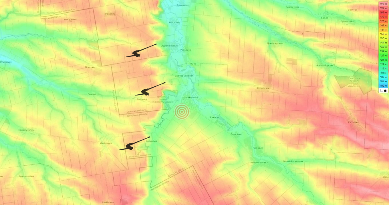
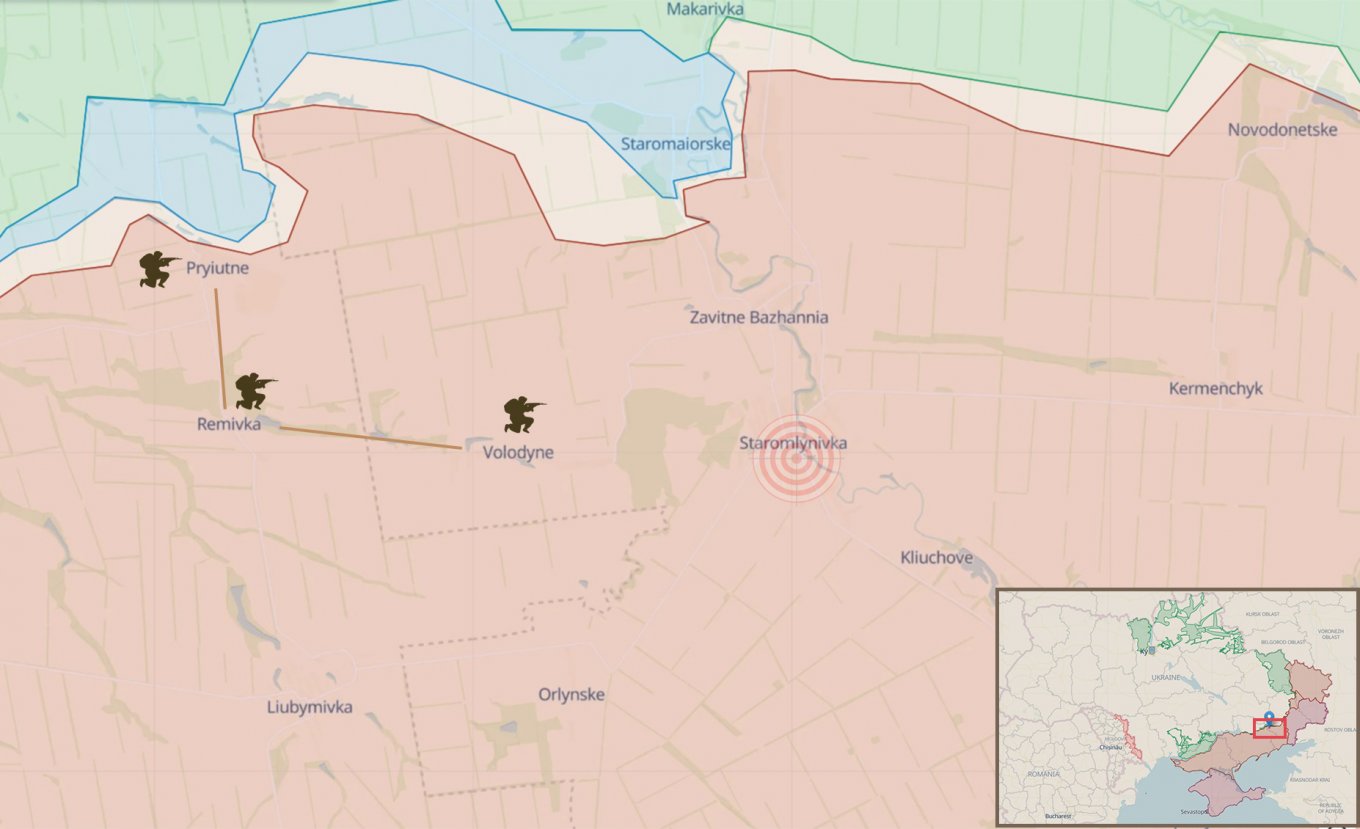
With that in mind, we should look closely at the movements along the heights as well. Analyst Kostiantyn Mashovets from the Information Resistance project noted that "the most activity over the past few days was in the area of the Pryiutne settlement and to the north-east of it."
Taking over the mentioned settlement and further to Remivka and Liubymivka would mean gaining access to the key heights and creating the conditions for an offensive on the "crossroad" – Staromlynivka – as this sturdily fortified settlement finds itself enveloped by Ukrainian forces from the west, moreover, exposed to artillery fire from the high grounds.
The russians realize the situation, too, for that reason their command keeps a potent force in long these heights. According to Mashovets, the russian 336th Marine Brigade and the 34th Motor Rifle Brigade hold the lines on the Pryiutne – Remivka – Volodyne axis.
Read more: Ukraine’s Troops Gradually Moving Forward To South of Bakhmut