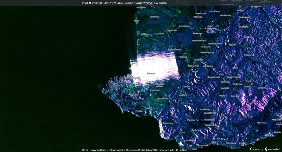
The extent of the russian federation's use of electronic warfare (EW) to safeguard its military assets is literally visible from space. The powerful electromagnetic interference has been reflected in the images made by a satellite employing Synthetic Aperture Radar (SAR) technology.
For a brief reminder, SAR enables image acquisition through radar, enabling it to "see" through clouds, fog, smoke, and regardless of how much sunlight illuminates the surface (i.e., at night as well). More details here:
Read more: What Is the ICEYE Satellite Purchased With Bayraktar TB2 Funds and Why it Really Makes a Difference
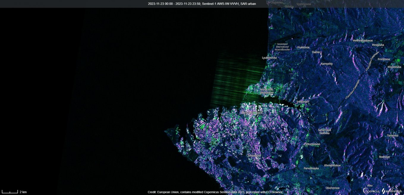
Back to the topic, when looking at the Crimean Peninsula, the publicly accessible images from Sentinel-1 reveal distinctive interference patterns, resembling "lens flares."
For example, one of such "lens flares" appeared in the picture from November 23:
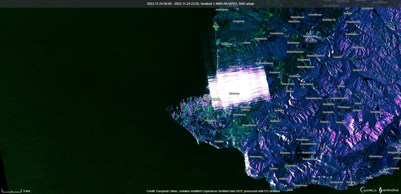
Then, the image from November 24 exhibits intense interference patterns coinciding with the mass drone attack on occupied Crimea, with dozens of Ukrainian attack UAVs reported by the russian side.
It is not entirely clear why the russians turned on EW protection on November 23, as seen in the first image. Maybe they decided to keep the equipment switched on after the reported naval drone attack on November 22, or anticipated another wave they chose to remain silent about.
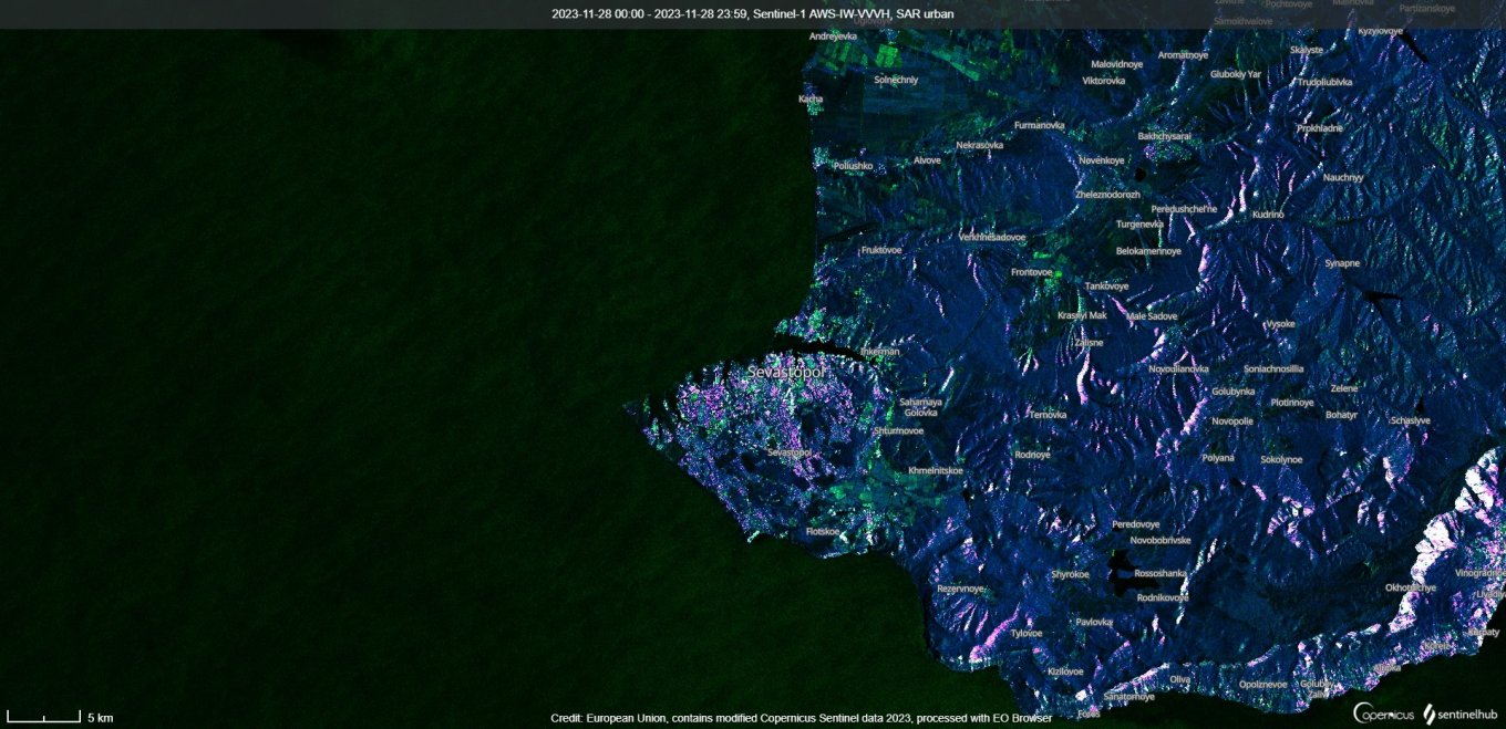
Observations indicate that activation of EW systems is intermittent, for we see no discernible "lens flares" in the latest November 28 image.
Analyst Damien Symon, who noticed these "flares," also highlighted the active satellite navigation spoofing in occupied Sevastopol, the main operating base of the russian navy's Black Sea Fleet, Naval News reports.
This is how Symon explained the errors in the AIS (automatic identification system) suggesting several ships and boats have "teleported" 8 km into dry land.
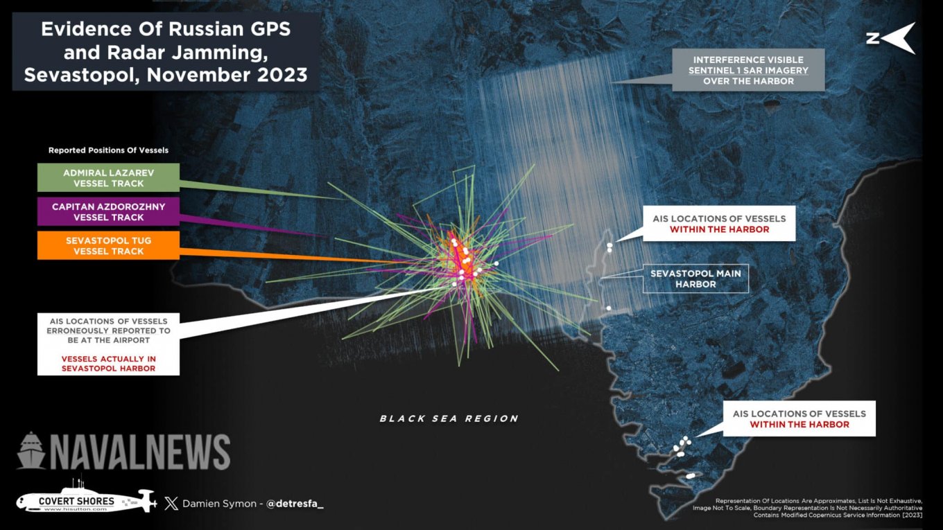
Notably, SAR images reveal heightened EW activity primarily in Sevastopol, no similar luminance noise recorded in other places on the peninsula. It means russians have concentrated their most potent EW assets in Sevastopol specifically.
Read more: Minsk Landing Ship and Rostov Na Donu Submarine Destroyed Thanks to the Ukrainian SAR Satellite