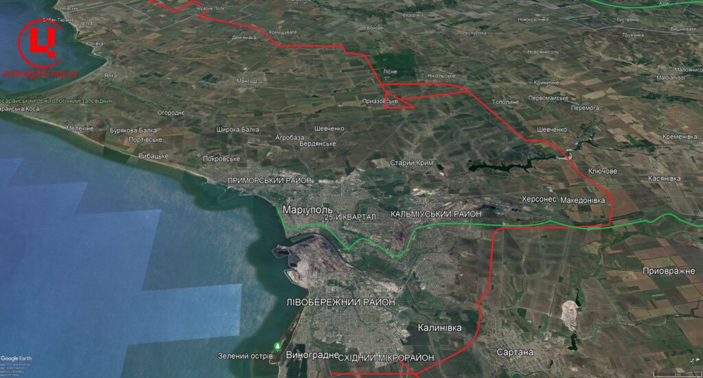
According to the Center of Journalistic Investigatigations, Sentinel-2 satellite images show that from April 26 to May 12, construction works have noticeably advanced by 25 kilometers on the section of Krasne Pole village to the village of Osipenko. There, the road turns south towards Staropetrivka village.
Sentinel-2 satellite data, May 12, 2024 / Graphics: investigator.org.ua
Read more: They in russia Admitted That from 2030 the Country Will No Longer Have Civil Aviation
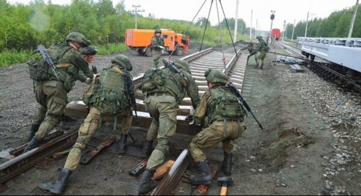
By analyzing satellite data, it is possible to see how at the railway line between Berdiansk and Mariupol will look like.
It is known that russians are building the railroad in Berdiansk together with the bypass road to the north of Mariupol. So, a new section of the land corridor could consist of road and railroad.
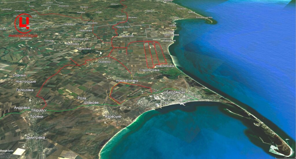
Obviously russians will lay the tracks from the village of Staropetrivka, near Berdyansk to the military base at the airfield, where the new branch line connects with the existing railroad. It starts at the port and heads to the north of Zaporizhzhia Oblast to the frontline town of Polohy.
Earlier Defense Express reported that russians had trained their troops at the largest training area in temporarily occupied Mariupol.
Read more: Mass Attack of russian Tank-Sheds Gone Wrong