The Kakhovka Reservoir was created in 1955-1958 after the Kakhovka hydropower plant was commissioned, it raised the water level 16 meters up. The length of the lake is 230 km, and it stretches from the major city of Zaporizhzhia all the way to Nova Kakhovka town. It is 9.4 km wide on average and 24 km at the widest point, the total area is 2155 km², and the volume is 18.2 km³.
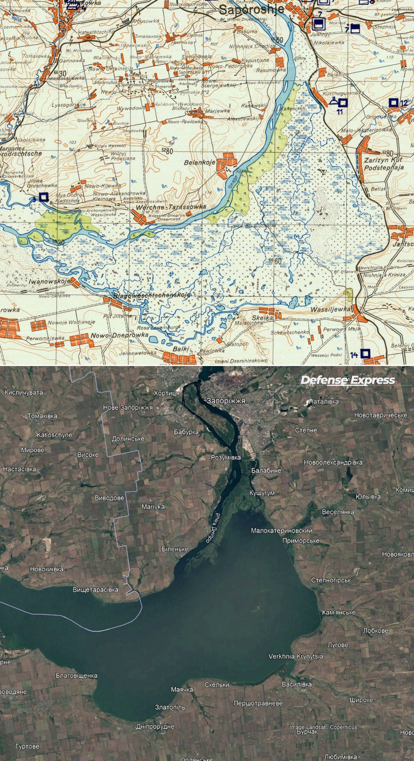
However, these parameters pertain to the body of water when the dam of the Kakhovka HPP is there. Now that it's been blown up by the russians, according to Ukrainian reports, the water rapidly escapes the reservoir. Ultimately, the Dnipro River should return to its original state before the dam was constructed. And we can imagine what it will look like thanks to the maps created before 1955.
Read more: What Could Happen With Water Supply, ZNPP, Crimean Canal Next After Kakhovka HPP Dam Demolition
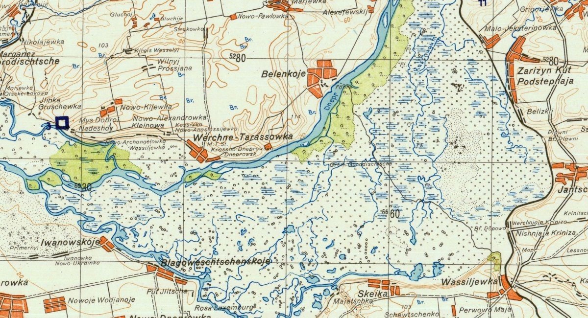
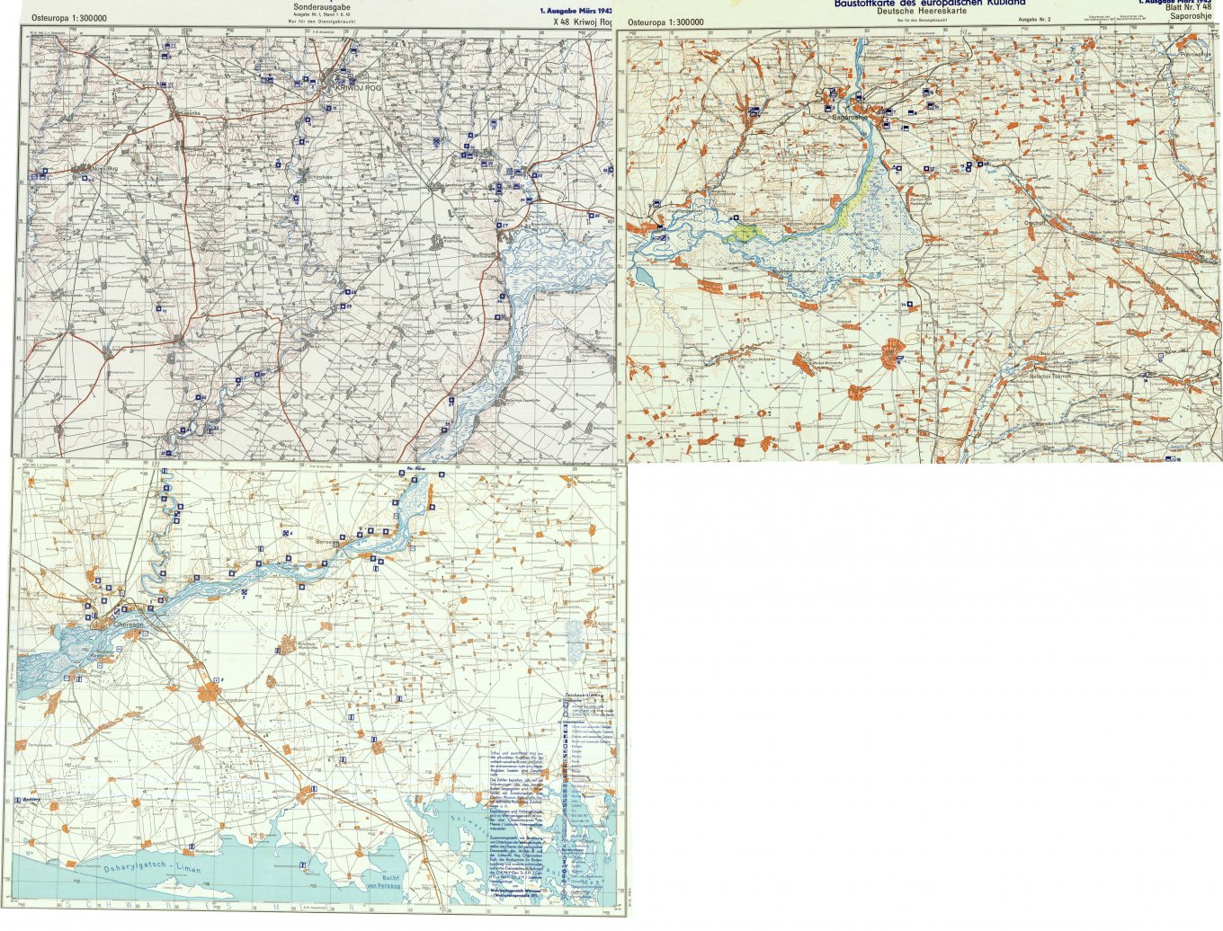
For example, here are detailed maps created by German general staff in 1943, they give a look into what awaits Ukraine in the near future. Below we made a selection of three maps of the areas near Zaporizhzhia, Kryvyi Rih, and Kherson cities in southern Ukraine. Although we should point out that these cannot be interpreted as reliable sources for modeling. In particular, they don't take into account the cascade hydropower plant activity upstream from Zaporizhzhia city.
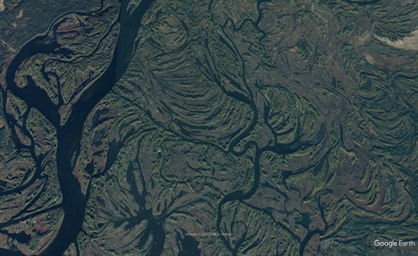
Instead of a reservoir, there were large floodplains, this area went underwater during the dam construction, the historical name for this area is Velykyi Luh (Large Plain). There is another similar floodplain in northern Ukraine, in the lower reaches of the Desna River which illustrates the character of this terrain.
The most significant changes await the areas adjacent to the Dnipro River near Zaporizhzhia city, at the widest point of the Kakhovka Reservoir.
There is also a potential threat of water level dropping in the cooling pond of the nearby Zaporizhzhia nuclear power plant (ZNPP). However, Ukrainian nuclear energy operator Energoatom reported that "the drawdown of water from the Kakhovka Reservoir does not directly affect the drawdown of water level in the ZNPP cooling pond" and there are other ways to maintain the active plant's safety.
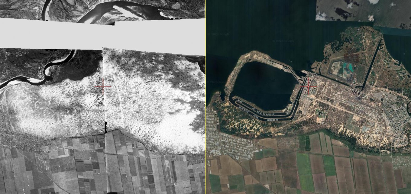
The ZNPP area on the old maps looks like this:
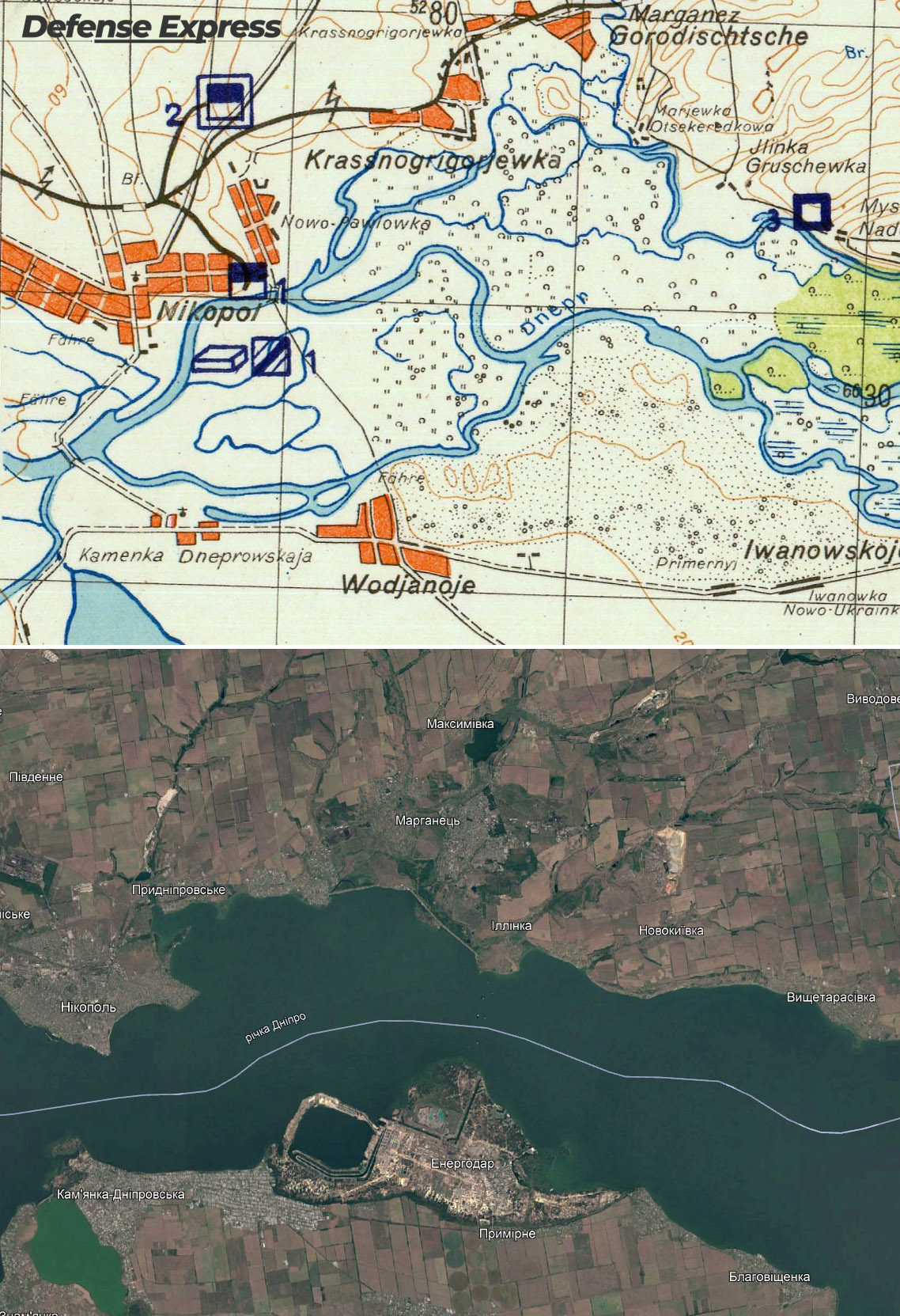
Based on the 1943 edition map, the nuclear power plant is basically located on a spot where the Dnipro channel was in the past. Here's also a German satellite photo made the same year: the cooling pond is situated where Dnipro once ran. Though such an old map and photo are not reliable sources for an assessment.
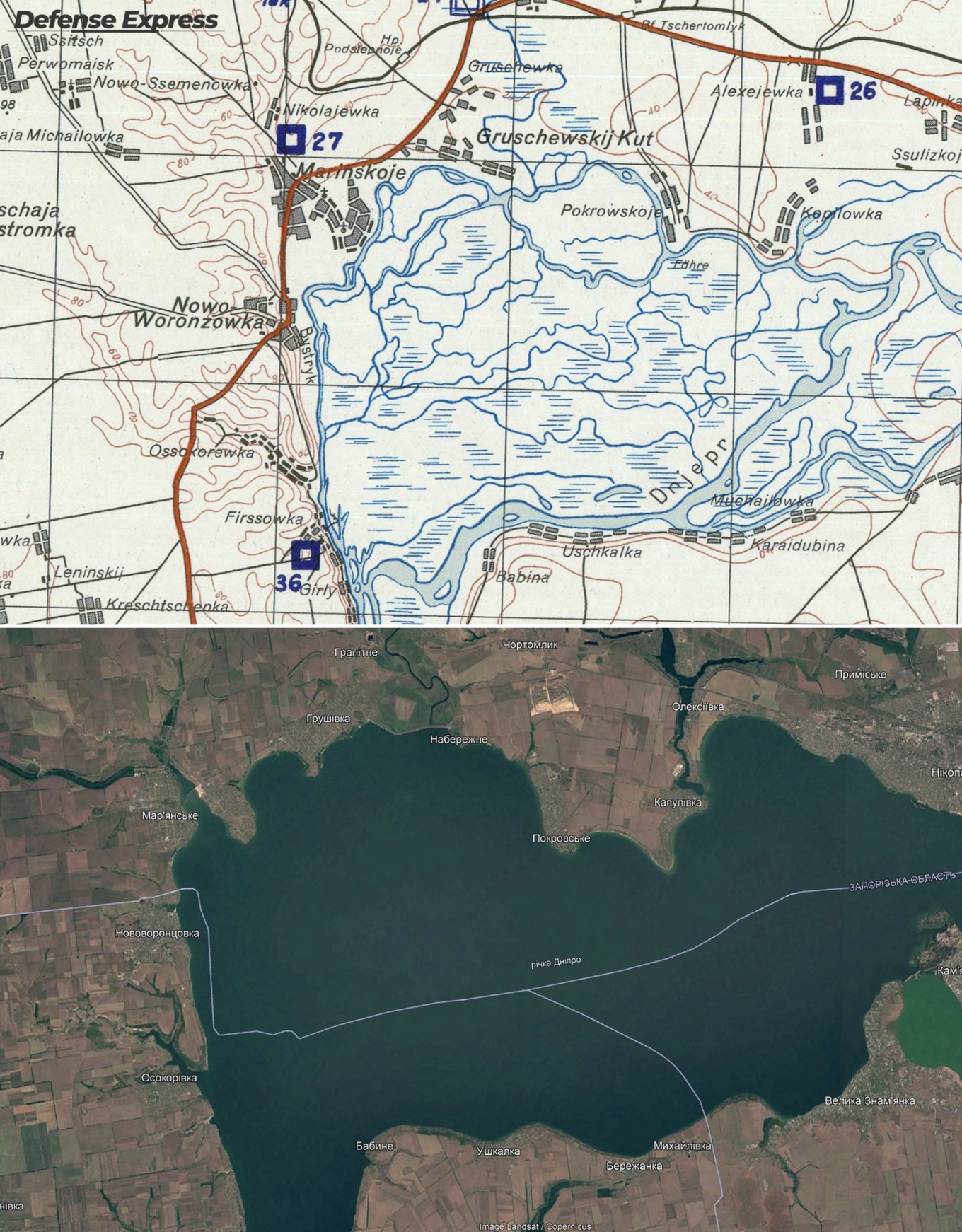
This is how Dnipro looked further down the stream near Nikopol and Babyne:
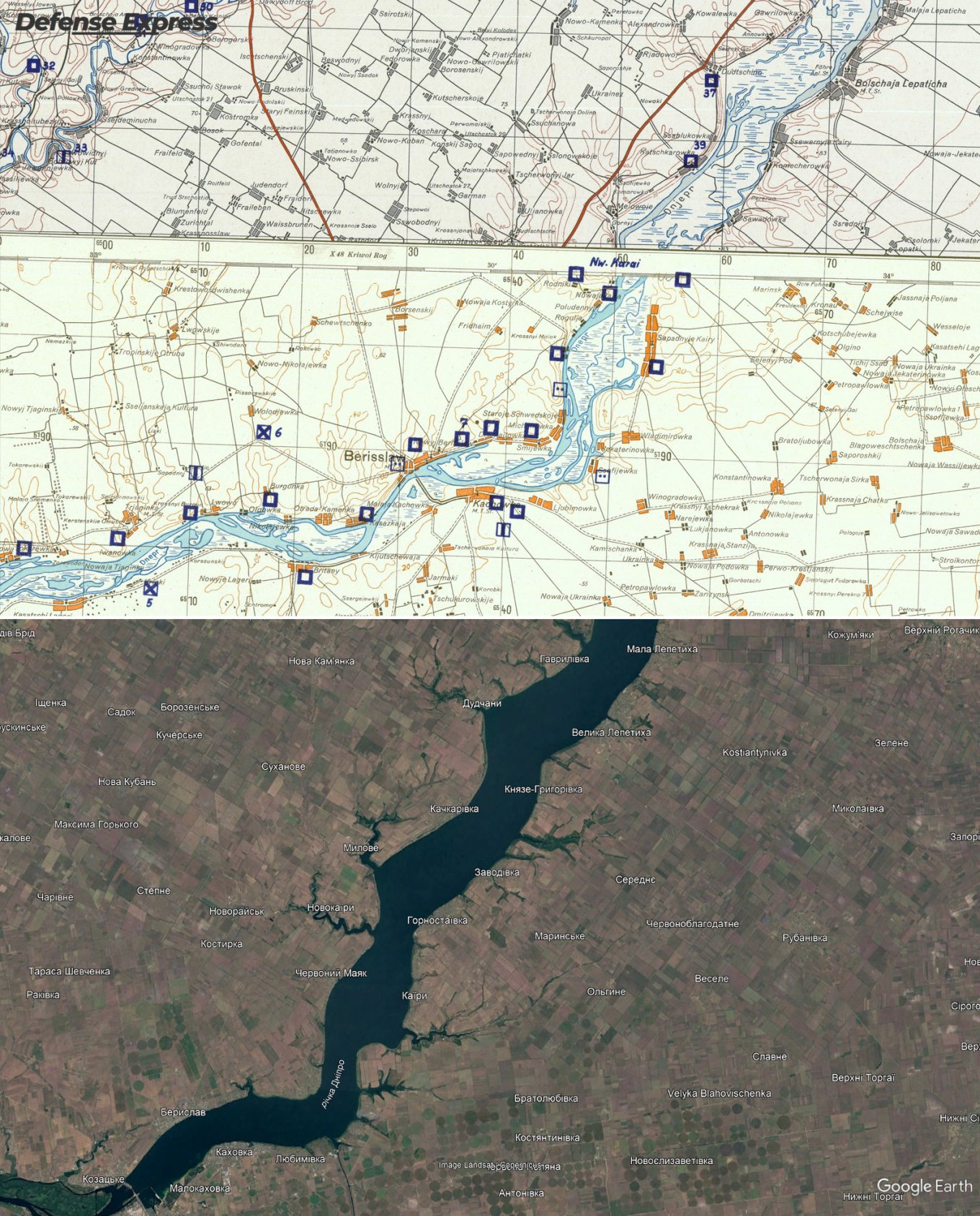
The least hydrographic changes await the lower part of the reservoir:
At the same time, the destruction of the Kakhovka dam will have much more far-reaching consequences, given the importance of the reservoir for the entire south of Ukraine. It will affect all hydrotechnical facilities in the region used for irrigation and water supply to settlements, including the entire russian-occupied Crimea.
Read more: Ukrainian Border Guards Showed How Their Mini-MLRSs Will Eliminate russian Infantry (Photo)


