The Kakhovka reservoir remains a very difficult terrain to traverse even after russians blew up the hydroelectric power plant. Therefore, it is still very difficult to conduct military operations here.
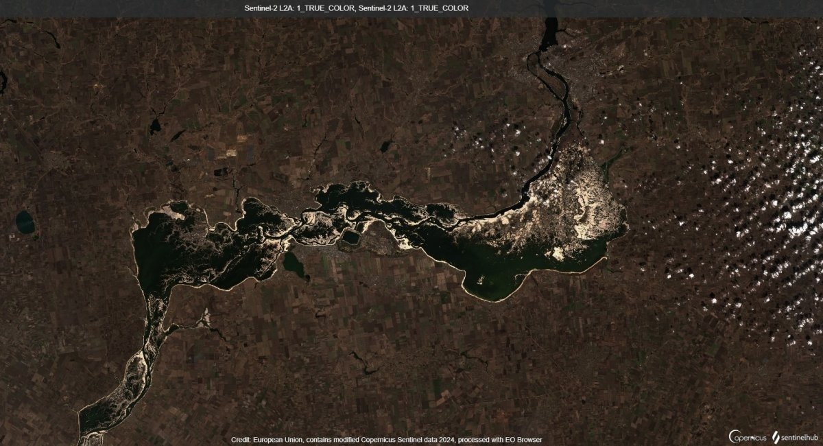
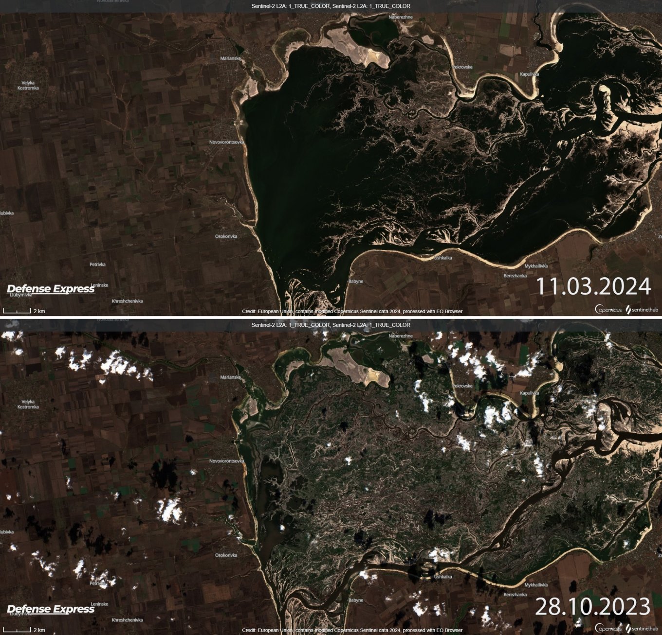
Public Sentinel images by the European Space Agency show that an option of the drained Kakhovka reservoir facilitating river crossing operations is improbable. To understand it clearer, it is better compare images of March 11, 2024 and October 28, 2023.
Read more: Satellite Shows How Many russian Mi-28, Ka-52 Helicopters, Su-25 Jets are at Dzhankoi Airfield (Photo)
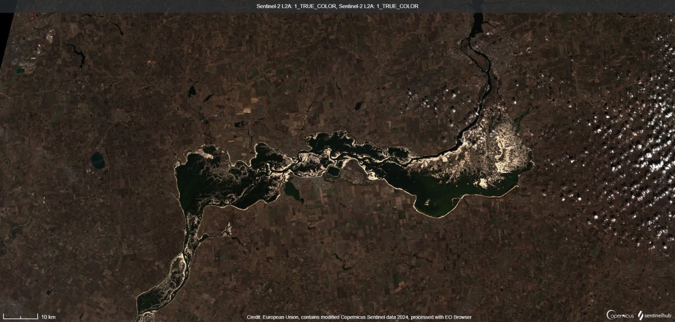
In particular, at the end of October 2023, the former Kakhovka reservoir looked like this:
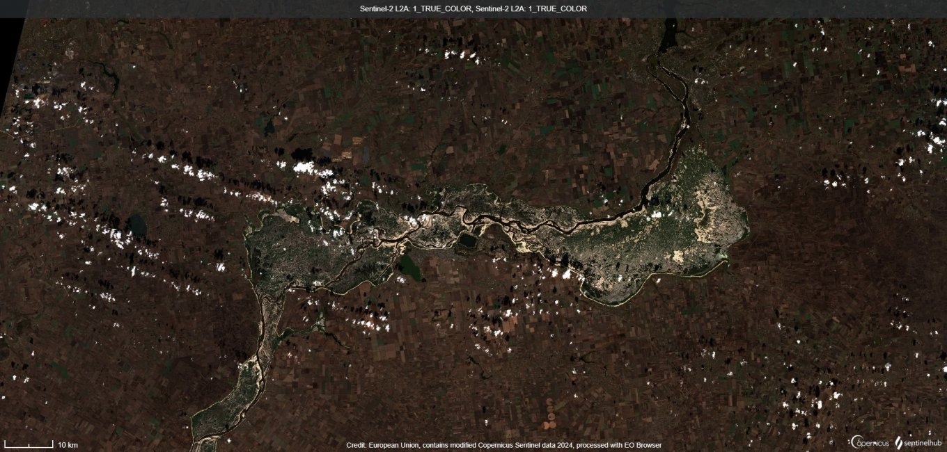
Images show that Dnieper has already returned to its historical channel, and the entire area resembles what is depicted on historical maps. But in mid-March 2024, the same area looks like this:
Obviously, due to the natural processes of snowmelt, a large area of this territory is under water again. This means that, soil will be very soft when the water comes back. No equipment, including amphibious vehicles, will be able to pass there.
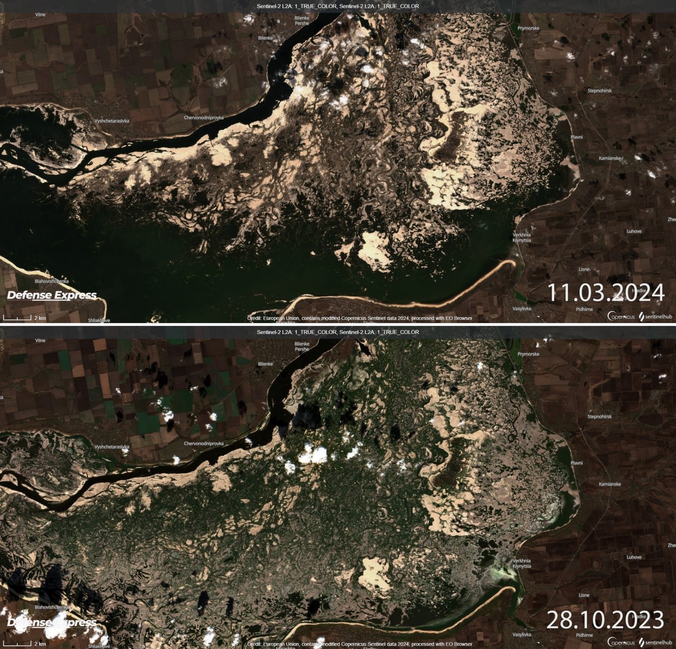
We can also have a look at more detailed images. For example, the biggest changes are noticeable to the east of Enerhodar:
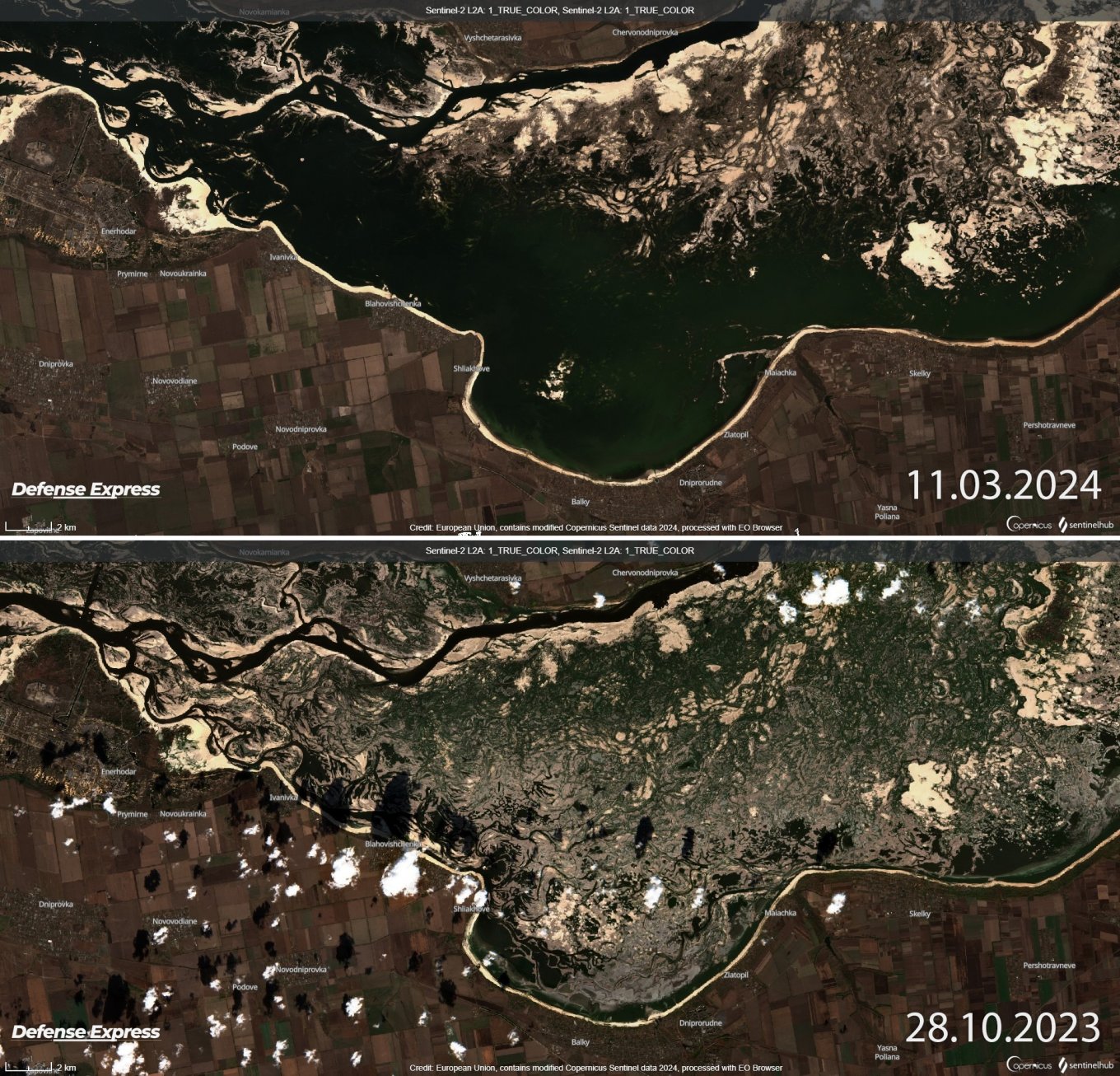
Opposite the Zaporizhzhia Nuclear Power Plant, where the width of the Dnieper has become much wider at the right bank:
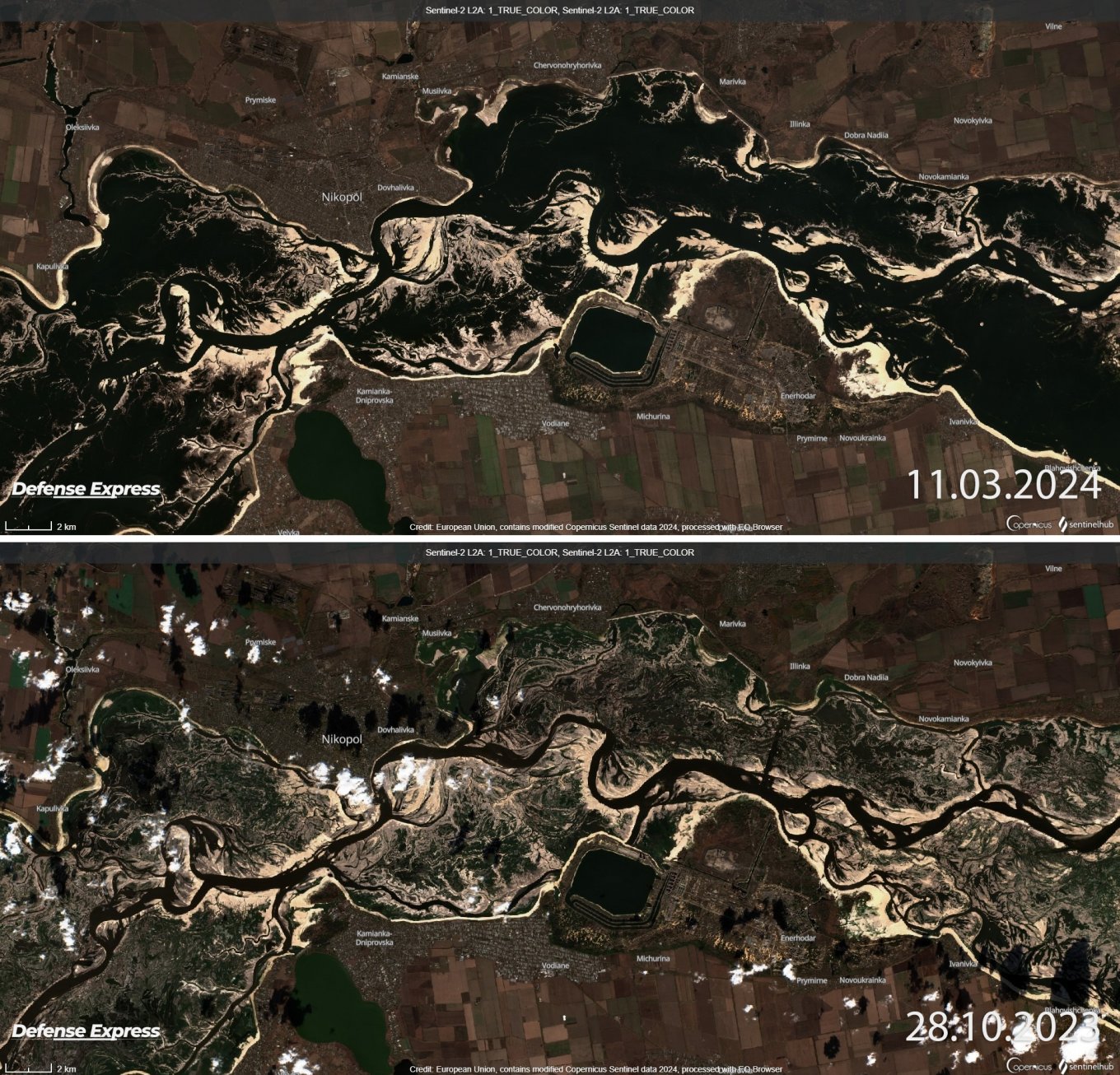
And also to the east of Zaporizhzhia NPP, in the area of Novovorontsovka and Osokorivka, where the width of the water surface has actually returned to the level before the Kakhovka HPP was blown up:
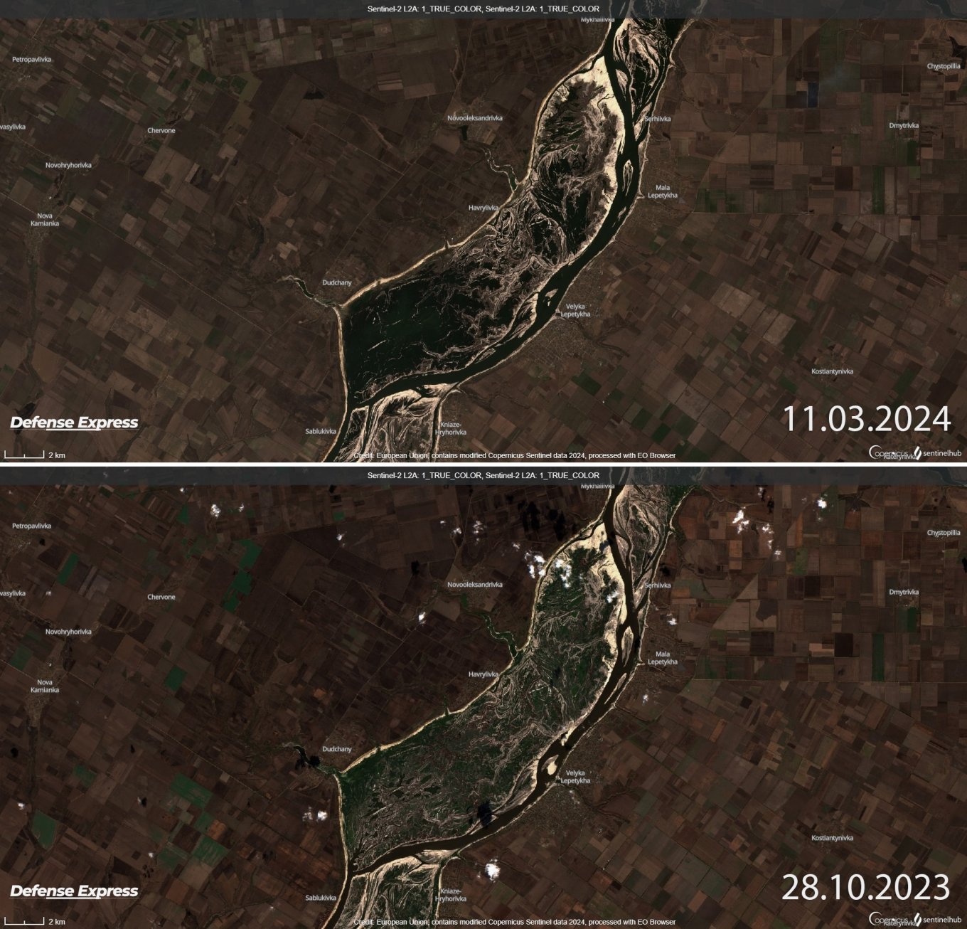
At downstream changes are smaller. The photos below show the area around villages of Dudchany as well as Velyka Lepetykha:
There are also smaller changes at the south of Zaporizhzhia. But all this space is impassable.
Thus, despite the fact that the Kakhovka reservoir has been drained, this area is the least suitable for any advance. The reason is a combination of the Dnieper riverbed, floodplains, wetlands, and flooded areas as well.
The conditions that have formed on the site of former Kakhovka reservoir are the natural state of Velykyi Luh. Velykyi Luh is the historical name of the area where the giant river floodplains that once existed on the left bank of the Dnieper river. In September-October, the water level in this area is minimal as sell as in the beginning of spring and until mid-summer, the area turns into an almost continuous water space.
Earlier Defense Express reported that Ukrainian naval drones had denied russian supply chain from Mediterranean to Black sea.
Read more: russians Enhance Strike Tactics, Posing a Significant Threat to HIMARS, Patriot, Helicopter Pads, etc